
 TARRANT COUNTY, TX

 Tarrant County Archives
Maps and Plans
Maps and Plans
Tarrant County Archives has an extensive collection of local and regional maps, plans, and architectural plans. These materials consist of original and copy prints. Below are links to the Maps and Plans Database broken down by date ranges. These lists are not continually updated as new materials are accessioned, so please contact us if you don't see what you're looking for.
The map database will provide you an inventory of our collection of maps, plans, and architectural plans:

Additional historic Tarrant County maps may be found in the Transportation Department Collection.
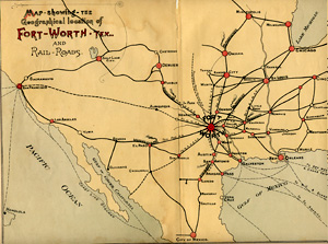
Examples:
- Tarrant County Plat Maps
- Mansfield Plat Maps
- Wedgwood Addition Plat Maps
- Mistletoe Heights and Dedication
- General Land Office 1885
- Sam Street's 1895 Map of Tarrant County
- Fort Worth, 1925
The following index is available in PDF format. Once the PDF is open, either browse by date or right click anywhere on the document and select "Find" from the drop-down box to enter a search term. This is not a complete representation of maps, plans, and architectural drawings available.
Tarrant County Sanborn Fire Insurance Maps available through the University of Texas at Austin:
- Arlington - 1900, 1905, 1911, 1917
- Fort Worth - 1885, 1889, 1893, 1898, 1910, 1911, 1923, 1926
- Grapevine - 1921, 1935
- Mansfield - 1921
The following map shows locations of cemeteries within Tarrant County as of February 2011. Sources: Texas Historical Commission, TxDOT Public Comments, Cemetery Websites, and Tarrant County Historical Commission.